CONCRETE CORING COMPANY
PROJECT
Finding Emily Geiger
PROJECT HIGHLIGHTS
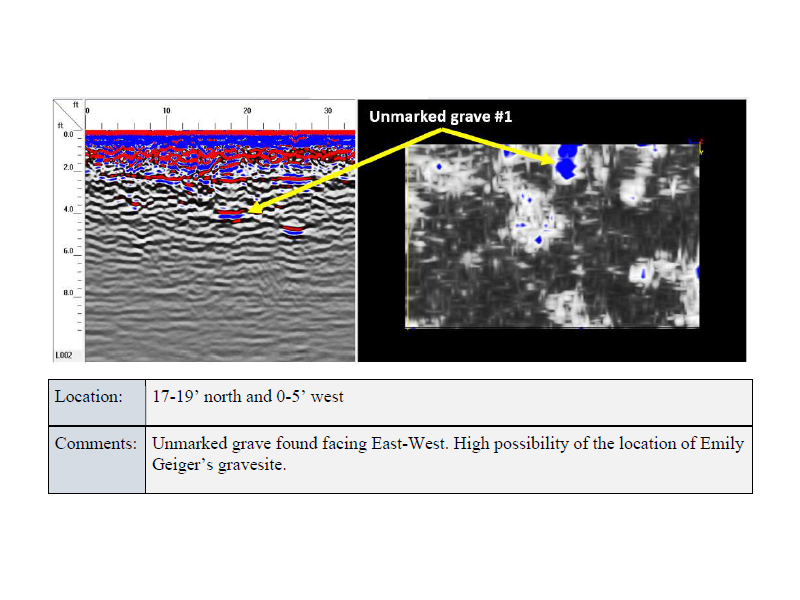
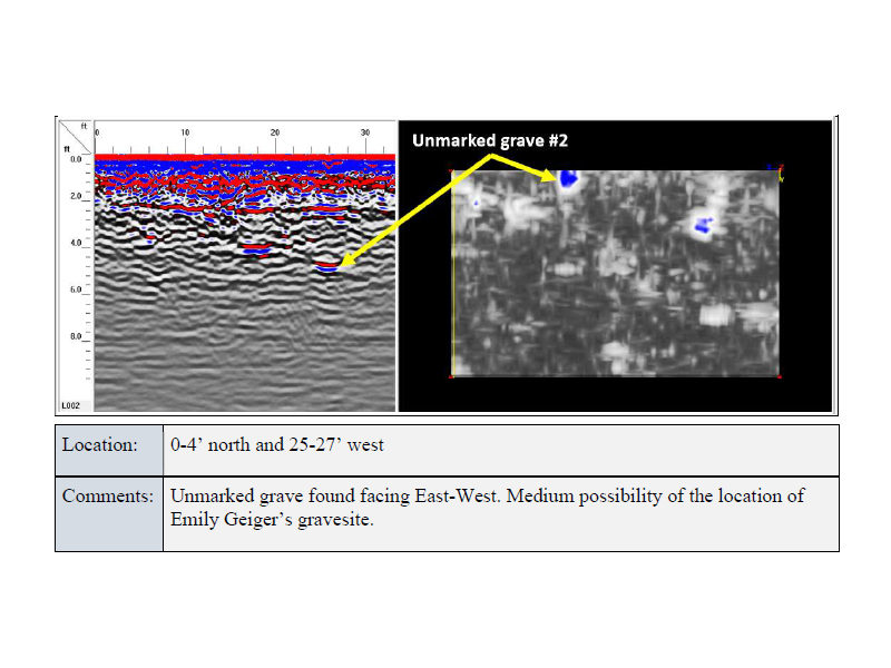
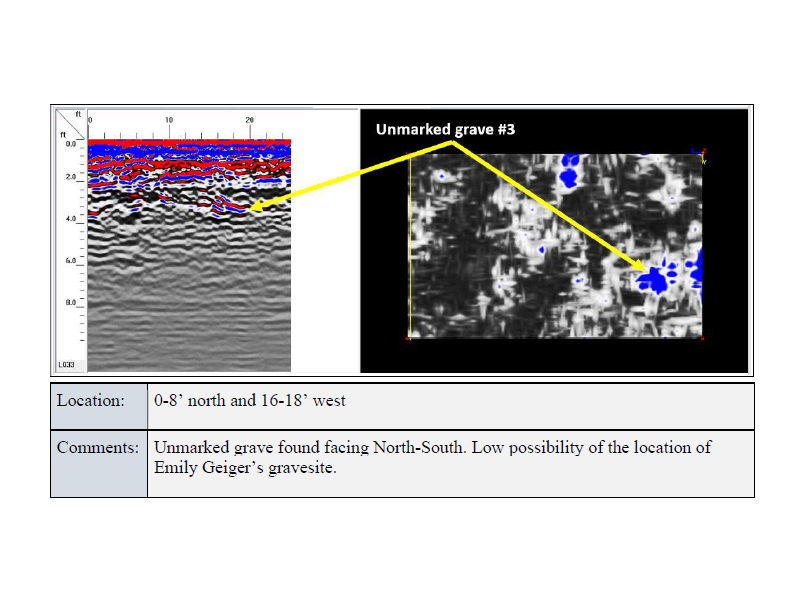
The purpose of this survey is to determine the probable burial locations of unmarked graves, using Ground-Penetrating Radar (GPR). GPR is a geophysical prospecting technology that transmits pulsed radio waves into the subsurface. Reflected radio waves from differences in dielectric permittivity build a map of the subsurface. Mapping these changes in relative dielectric permittivity and looking at depth slices of data in a cross-section (X-Y Plane) show differences in conductivity. This conductivity can be used to determine relative differences in densities and properties in the subsurface, thus potentially identifying burial locations.
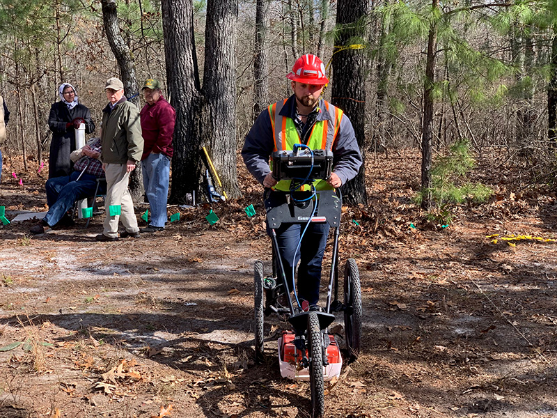
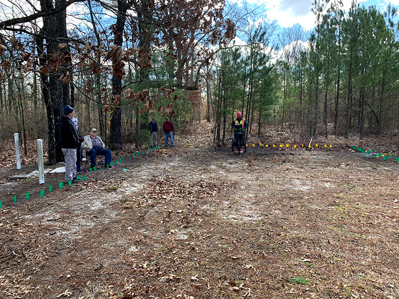
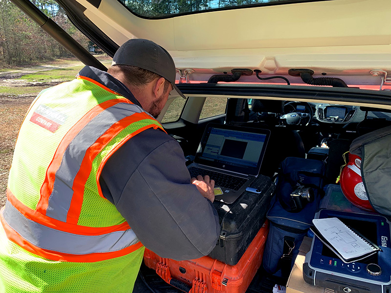
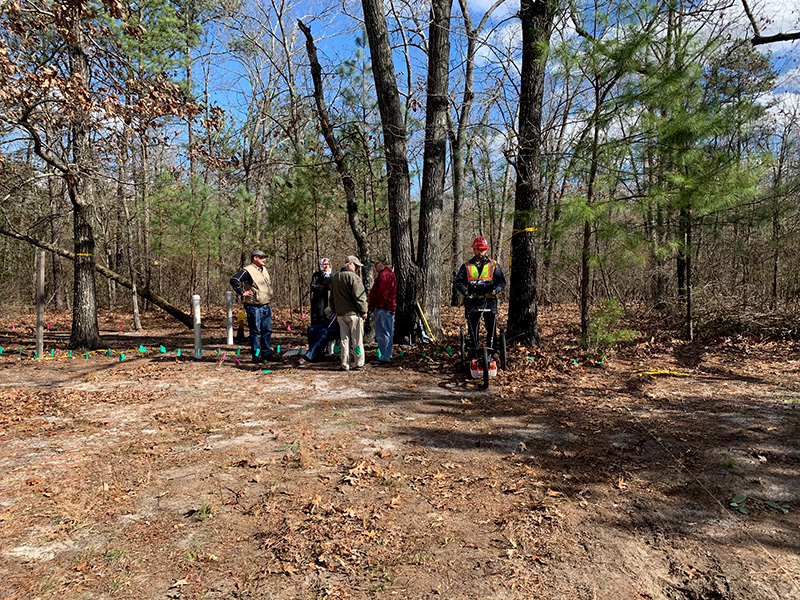
Using a three-wheel cart, mounted with an GSSI SIR 4000 and a 400 MHz antenna, 2D scans and 3D scans were taken. To determine probable areas of unmarked graves preliminary 2D scans were taken and areas of interest were flagged. After determining a few areas of interest, a grid was built to include all areas of interest while maintaining a manageable area based on site conditions. The determined area included a 40-foot by 25-foot rectangle of 1000 square foot area. In this site, three locations of interest were included. Grid spacing was determined to provide the best data at 1-foot intervals allowing for the most data to be collected and presented. Radan 7, a post processing tool for geophysical investigations, was then used to combine the X and Y files into a 3-dimensional file. An IIR filter, background removal filter, and migration were applied to the data. Gain and Color X Forms were then chosen to best present the data.
- The processed data showed three separate locations that present possible locations of unmarked graves.
- These locations can be found based on the location of the origin point that was designated by the grid spacing marked with PVC pipe and metal, which can be found with a metal detector.
- These locations were proposed upon the fact that the areas showing a higher relative dielectric permittivity can be seen with the decomposition present in the graves of this age in the soil matrix.
Being a life-long South Carolinian, it is great to be a part of this project. To shed some light on Ms. Geiger’s importance in not only South Carolina, but U. S. history, has been a really cool experience. I’m excited to see what the Historical Society has planned moving forward to honor her.
-Darren Eubanks